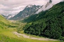
Uttarakhand
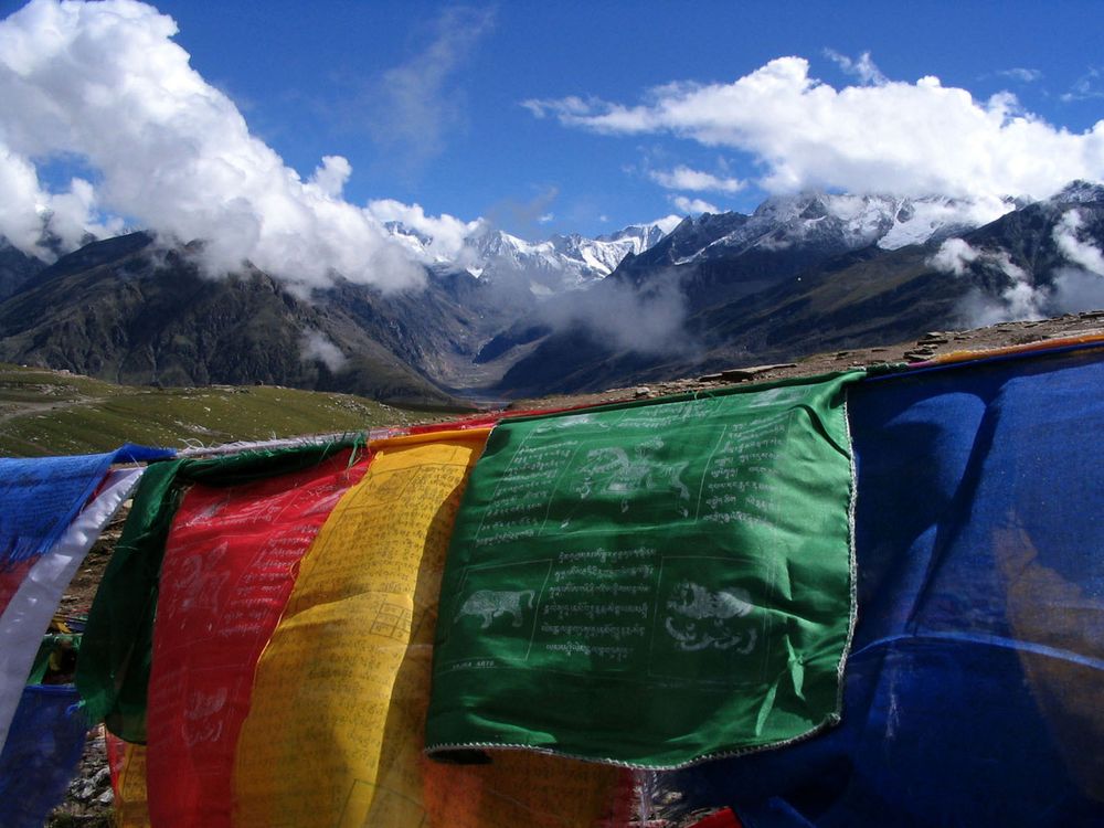
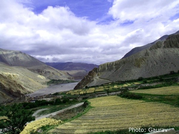
Uttarakhand is a state in the northern part of India. It is often referred to as the “Land of the Gods” due to the many holy Hindu temples and pilgrimage centres found throughout the state. Uttarakhand is mainly known for its natural beauty of the Himalayas, the Bhabhar and the Terai.
Chopta Tungnath
A beautiful six days trekking trip with excellent views of Himalayas. The trek route goes through Deoria tal, Chopta, Tungnath and finally to the Chandrashila Summit which gives an unobstructed view of Himalayas.
Trip Duration: 7 Days – April 01 – April 07
Minimum: 05 Participants
Mountain Biking in the Garhwal Himalayas: 06 Days
A beautiful six days mountain biking tour in the Garhwal Himalaya offers mountain biking experience with easy to moderate difficulty level. Logistics support is provided by a support vehicle and qualified staff, which transfers camping equipment, luggage and supplies during the entire tour.
The cycling route has very less traffic, and passes through small villages and forests. One would get beautiful views of snow clad mountains, vast valleys and the Bhagirathi River along while cycling from Kanhatal to Devprayag where the river Bhagirathi and Alaknanda meets to name the ‘Holy Ganga’.
Trip Duration: 6 Days
Minimum: 05 Participants
Har Ki Doon
Nestling in the north-western corner of Garhwal, Har ki Doon is truly the Gods valley, which happens to be the translation of its name. Lying along the Tons River, a main tributary of the Yamuna, Har ki-Doon is dominated by the peaks of Swargarohini and Banderpunch and its rivers and streams originate from the glaciers of these two mountain massifs.
The people of this valley trace their ancestry back to the days of Mahabharata and claim to be the descendants of Duryodhana and his followers who are still worshipped in ways quiet unique and different from all other temples in India.
Trip Duration: 7 Days – May 01 – May 07
Location: Uttarakhand
Season: May/June
Grade: Easy
Minimum: 05 Participants
Valley of Flowers
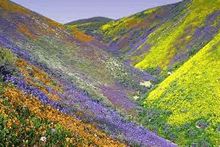
High in the Himalayan Ranges of Garhwal hills of Uttarakhand lays an enchanted valley. Here flower-laden pastures with clear running streams are set against silver birches and shining snow peaks. Dew lies thick on the flowers, birds sing and the air is pure and charged with floral smells. Hidden from the probing eyes of civilisation, this valley has been known to the inhabitants as the Bhyundar Valley, the playground of fairies and nymphs. Trespassing their celestial abode was avoided although the shepherds did take the liberty to graze their cattle here. Frank S. Smith – mountaineer, explorer, botanist, who camped here for several weeks in the monsoon of 1937 and did valuable exploratory work, introduced the valley to the world as the Valley of Flowers.
Trip Duration: 7 Days
Location: Uttarakhand
Season: Aug/Sep
Grade: Easy
Minimum: 05 Participants
Kuari Pass – Lord Curzon Trail
Ascend through alpine meadow to the Kuari Pass and gain impressive views of the Great Himalaya and Zanskar Range Before continuing through mixed forest and traditional Hindu villages.
Trekking over the Kuari Pass affords some the finest views of the Himalaya – including the many peaks near Nanda Devi. This trek was a favourite of the British trekkers. The pass was often referred to as the Curzon Pass because of former Viceroy George Nathaniel Curzon’s love for the region, although he never crossed the pass; his party turned back after an attack by a swarm of bees!
Although the Kuari Pass (3640m) is not high by Himalayan standards, take an additional day for acclimatization, particularly if considering camping near the pass.
Brief Itinerary
Day 01: Auli – Chitraganta Meadow (3310m, 15 kms/ 6-7 Hrs)
Day 02: Chitraganta – Dakwani (via Kuari Pass – 14 Kms/ 4- 5 Hrs)
Day 03: Dakwani – Ghangri (16 km/ 7 Hrs)
Day 04: Ghangri – Ramni (15 km/ 5- 6 Hrs)
Day 05: Ramni – Ghat (15 km, 5- 6 Hrs)
Duration: 8 Days – May 24 – May 31
Distance: 75 Kms
Difficulty: Moderate
Start: Auli
Finish: Ghat
Nearest Town: Joshimath
Pindari Glacier
One of the most popular treks in Uttaranchal; ascend through Hindu villages, mixed forests and open meadows to view the peaks and passes above the Pindari Glacier.
The trek offers well-defined trails with only one minor pass crossing en route to the Pindari Glacier. The views from the pass – the Dhakri Khal (2830m) – are particularly impressive and include the many snow-capped peaks that form the southern rim of the Nanda Devi Sanctuary. The views from above the Pindari Glacier are also striking, particularly for the first time trekker.
The route is very popular with Indian students during school holidays in May and June and many of the lodges and dhabas are full. However, there are few pilgrims. This is surprising considering that the Pindari River is one of the main tributaries of the Ganges.
Acclimatisation is essential. Spend an additional night at Dwali (2650m) before ascending to Phurkiya (3250m) and the Pindari Glacier.
Brief Itinerary
Day 1: Song – Dhakri (6-7 Hours, 16km)
Day 2: Dhakri – Dwali (6-7 hours, 16km)
Side Trip: Sunderdhunga Glaciers (3 Days, 54km return)
Day 3: Dwali – Phurkiya (2 .5 – 3 Hours, 7km)
Day 4: Pindari Glacier (Zero point) Day Trek (5-6 Hours, 16 Km)
Day 5 to 7: Phurkiya – Song (3 days, 39 km)
Duration: 7 Days
Distance: 94 Km
Difficulty: Easy
Start/Finish: Song
Nearest Town: Nainital
Roop Kund
Trek through traditional Hindu villages and ascend through mixed forest and alpine meadows to the mysterious lake of Roop Kund.
For many years, Roop Kund has attracted attention because of the human skeletons clearly visible at the bottom of the shallow lake. Pilgrims and trekkers ascend the extensive bugyals to the small and often snow bound lake set beneath the impressive backdrop of Trishul (7120m).
The trek can be completed either at Ghat or Mundoli, although extra time should be reserved for acclimatisation if trekking from Mundoli. This trek can also be combined with the Kuari Pass trek.
Brief Itinerary
Day 1: Ghat – Ramni (7 Hours, 15 km)
Day 2: Ramni – Sutol (6-7 Hours, 16 km)
Day 3: Sutol – Wan (5 Hours, 14km)
Alternative Route: Wan to Mundoli (3 -4 Hours, 10 km)
Day 4: Wan – Bedni Bugyal (5 Hours, 11km)
Day 5: Bedni Bugyal – Bhugu Basa (4-5 Hours, 10km)
Day 6: Bhugu Basa – Roop Kund (Return to Bedni Bugyal) (7-8 Hours, 18 km)
Side Trip: Jyuri Gali & Hom Kund (7 hours, 12 km return)
Day 7: Bedni Bugyal – Mundoli (6-7 Hours, 17 km)
Duration: 7 Days
Distance: 101 km
Difficulty: Moderate
Start: Ghat
Finish: Mundoli
Nearest Town: Joshimath
Gaumukh – Source of the Legendary Ganges
Follow the pilgrim trail to Gaumukh before ascending to the meadow of Tapovan beneath the scared summit of Shivling.
The initial days of the trek to Gaumukh are followed by thousands of Hindu pilgrims enroute to sacred source of the Ganges. The pilgrims normally stay overnight at Bhojbasa and depart early the next morning to offer their darshans (prayers) at Gaumukh before returning to Gangotri. Other pilgrims on horseback complete the journey there are back in a day, as do those carried dandy, a wooden platform supported by a team of porters who charge around Rs. 3000 for the day.
Acclimatisation is essential before ascending to Tapovan (4450m). Reserve at least two days before ascending to Bhojbasa.
Beyond Gaumukh, the established trail gives way to a poorly defined route across scree and boulder fields to Tapovan. This meadow offers uninterrupted views of the Bhagirathi peaks, which define this part of the Himalaya Range.
Experienced trekkers may also consider the Gangotri Glacier side before returning to Gangotri.
Brief Itinerary
Day 1: Gangotri – Chirbasa (4 Hrs, 9 Km)
Day 2: Chirbasa – Bhojbasa (2-2 .5 hours, 5 km)
Day 3: Bhojbasa – Tapovan (5-6 hours, 10 km)
Side Trip: Gangotri Glacier to Nandanban & Gaumukh (7 Hours, 14 km)
Days 4 & 5: Tapovan to Gangotri (2 days, 24 km)
Duration: 5 Days
Distance: 48 km
Difficulty: Easy- moderate
Start/Finish: Gangotri
Nearest Town: Uttarakashi